
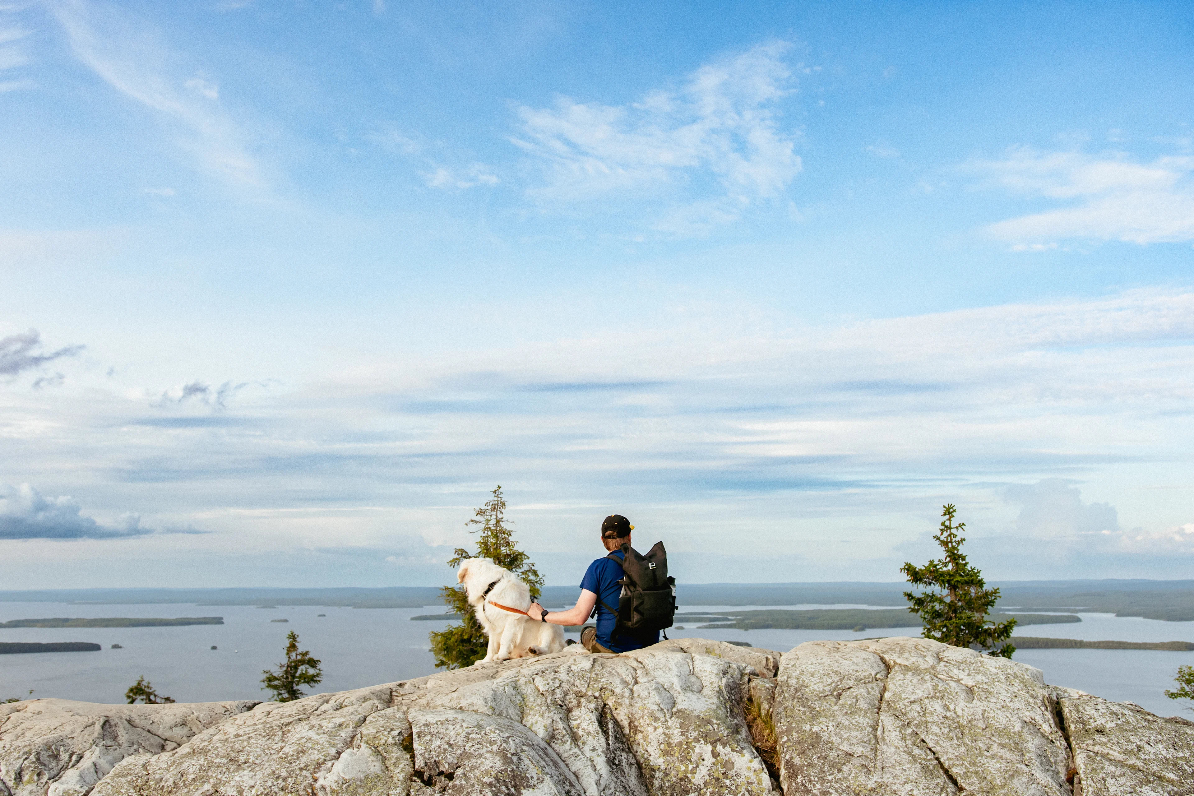
Visit nature attractions by train

Finland’s national parks a train trip away
You can easily reach many nature attractions and national parks in Finland by using public transport, without having to drive your own car for hours. The backpack and tent travel with you on the train, and you can use the travel time to plan hiking routes, for example.
Nature attractions and national parks on the map
Together with Metsähallitus, we have compiled a list of Finland's national parks and nature sites that you can easily reach without your own car. Explore destinations and check your arrival instructions.
Finland’s national parks and nature attractions that you can reach by train
Aulanko Nature Reserve, Opens in a new tab in Hämeenlinna has been a popular tourist destination for over one hundred years. Nowadays, the nature reserve in Aulanko offers tourists much more to see than just the beautiful scenery. The Aulanko parkland with its attractions and the traditional Finnish landscape, best viewed from the observation tower on Aulangonvuori, attract more than 400,000 visitors to the area every year. Aulanko is especially suitable for day trips, and some of the attractions in the area are also suitable for those travelling with an assistant or a pram.
How can I get to Aulanko Nature Reserve?
You can get to Aulanko Nature Reserve conveniently by train.
- There is a little over three kilometres to walk from Hämeenlinna railway station, Opens in a new tab to Aulanko. You can also take the local bus number 2, Opens in a new tab to Aulanko from the station.
- You can buy both a train ticket and a Hämeenlinna one-time public transport ticket in the VR Matkalla application.
In Southern Konnevesi, you can go on a boat on open lakes or kayak between the low smooth rocks and vertical rock walls of the archipelago. In this park of clear waters and breathtaking contrasts, you can hike from the leafy groves to the high cliffs to admire the spectacular home scenery of osprey and brown trout.
How can I get to Southern Konnevesi National Park?
You can get to Southern Konnevesi National Park by first travelling by train to Jyväskylä. The Outdoor Express bus takes you from Jyväskylä’s Travel Centre to the lake landscapes and hiking trails of Southern Konnevesi. The bus runs on six weekends during July-September, on Saturdays and Sundays. On three weekends, the bus will take you to the hiking trails in Törmälä Course Centre and on three weekends to the national park's water gateway at Häyrylänranta. You can also take a bike on the bus, and pets are allowed on Sundays.
Learn more about the Outdoor Express bus connection here., Opens in a new tab
The rugged landscapes of Helvetinjärvi National Park with its valleys and gorges are breathtaking. The most famous gorge in the area is Helvetinkolu. There is a vantage point near Helvetinkolu with a view of the glittering Iso Helvetinjärvi lake between the steep cliffs. Old forests border the valleys and small ponds. Hanging mosses and lichens sway in the wind from tree branches and shelf fungi bulge from tree trunks. Helvetinjärvi is also home to the Eurasian three-toed woodpecker that lives in old forests.
How can I get to Helvetinjärvi National Park?
You can get to Helvetinjärvi National Park by first travelling by train to Tampere. On summer weekends, the Outdoor Express bus takes you directly from Tampere railway station to restaurant Helvetin Portti in Kankimäki, which is the starting point in Helvetinjärvi National Park. The bus runs on a few weekends during July-September, on Saturdays and Sundays. You can also take a bike on the bus, and pets are allowed on Sundays.
Read more about the Outdoor Express bus connection here., Opens in a new tab
Known for its crystal-clear lakes, Hossa is a national park with ridge landscapes and numerous hiking trails. There are a total of about 90 kilometres of routes, hiking trails run through pine forests and marshes. Mountain biking trails offer a choice of journeys for up to 50 kilometres. There are three accessible routes for all travellers.
In Hossa, you can spot reindeer, a common sandpiper, a Eurasian three-toed woodpecker, a fox or an otter, for example.
How can I get to Hossa National Park?
You can get to Hossa National Park by first travelling by train to Kajaani, 170 km away, from where there is a connecting bus to Hossa.
Alternatively, you can travel from the train station to Kuusamo by bus and rent a car there.
Learn more about directions to Hossa National Park, Opens in a new tab.
Trails and the best attractions in Hossa National Park
The tour of Värikallio takes the visitor on a time journey to Lake Somerjärvi. The rock paintings on Värikallio date back to the New Stone Age and are at least 3,500 years old.
Muikkupuro is a shallow serpentine sandy bottomed stream that charms with its beauty. Next to the stream, there is the Muikkupuro lean-to shelter, which is by an accessible route.
The height differences and rocky slopes of Isojärvi National Park can make you breathless, but the landscapes are worth the climb. Forested mountains and deep valleys alternate in the landscape that was shaped by the ice age. Streams run among the old spruces and moss carpets adorn the forest in different shades of green. The hoots of the red-throated diver in clear water lakes and beavers floating almost silently on the surface of the water create an atmosphere of wilderness.
How can I get to Isojärvi National Park?
You can get to Isojärvi National Park by first travelling by train to Tampere. On summer weekends, the Outdoor Express bus takes you directly from Tampere railway station to Heretty Cabin Café in Isojärvi National Park. The bus runs on a few weekends during July-September, on Saturdays and Sundays. You can also take a bike on the bus, and pets are allowed on Sundays.
Read more about the Outdoor Express bus connection here., Opens in a new tab
Karhunkierros is one of Finland’s most famous hiking trails. The trail runs through the Kuusamo and Salla regions, through Oulanka National Park, and takes you through rapids, river valleys and forested hill views in varied terrain.
The trail is approximately 81 kilometres long and the hike usually takes 4-7 days, depending on the hiker’s experience and condition. There are several open wilderness huts and day-use huts along the trail, and you can also experience the Karhunkierros Trail in shorter sections if you wish.
How can I get to Karhunkierros?
You can get to Karhunkierros by first travelling by train to Kemijärvi or Oulu.
From Kemijärvi: The southern starting point of the Karhunkierros Trail is located in Ruka. There is a direct bus connection to Ruka village from Kemijärvi railway station once a day. Check the route’s stops and timetables in more detail on Matkahuolto’s website, Opens in a new tab. The bus is scheduled so that passengers of the Kemijärvi night train have the opportunity to transfer to the bus. The starting point of the Karhunkierros Trail is located six kilometres from Ruka Village along the road.
From Oulu: You can get to Karhunkierros with the bus connection from the bus station next to Oulu railway station to Kuusamo, for example. The Oulu-Kuusamo route, Opens in a new tab is operated several times a day. You can get to Ruka from Kuusamo with a bus connection once a day. You can check the connection's timetables and stops on Matkahuolto’s website, Opens in a new tab. You can also get to the starting point of Karhunkierros in Ruka by taxi from Kuusamo. The length of the taxi ride is approximately 27 kilometres. You can find indicative taxi fares on, for example, the local taxi company’s website., Opens in a new tab
The best sights of the Karhunkierros Trail
In the northern part of the trail, Rupakivi, Opens in a new tab is a high and unusual sculptured stone located in the Savinajoki river, which clearly stands out from the surrounding area. Along the way, you will also find Oulanka Canyon, a steep-walled and impressive ravine where the river has cut a deep ditch between the rocks.
From the Ristikallio starting point, Opens in a new tab, the landscape is characterised by rocky slopes and vantage points, the most famous of which is Ristikallio., Opens in a new tab In Taivalkönkä, Opens in a new tab the Oulankajoki River splits into two channels and forms a rocky rapids section, which the trail crosses via suspension bridges.
Kiutaköngäs, Opens in a new tab is one of the most famous rapids in Finland. At this destination, water rushes between vertical, red dolomite rocks in a ravine-like ditch. You can easily visit Kiutaköngäs for a short trip as well. It is located just a kilometre from Oulanka Visitor Centre., Opens in a new tab
The Karhunkierros partially overlaps with the popular Pieni Karhunkierros Trail, Opens in a new tab, which features several attractions. Jyrävä is a large and steep waterfall where Kitkajoki River falls into a narrow rocky ditch. The waterfall is about nine metres high and its sound can be heard from far away.
In the southern part of the trail, Karhunkierros rises to higher forested hills. The peaks of Konttainen and Valtavaara, Opens in a new tab offer expansive views over forests and waterways, and the landscape becomes increasingly open.
In Koli National Park, Opens in a new tab, you will find Finland’s most famous national landscapes. Koli has suitable routes for hikers of all levels. There are about 80 kilometres of marked trails, ranging in length from 1.5 kilometres to 61 kilometres.
On the steep trails of Koli, you can experience the enchantment of dangerous landscapes as part of the centuries-old continuum of visitors to Koli. Countless travellers throughout history, from ordinary wilderness travellers to well-known Karelian artists, have sought strength and inspiration from the wild landscapes of the expansive Pielinen. In addition to the landscapes and unique geological history of Koli, local attractions also include old agricultural flowering meadows and animals grazing during the summer.
How can I get to Koli?
You can get to Koli by first travelling by train to Joensuu.
- The distance from Joensuu railway station to Koli , Opens in a new tabis about 70 kilometres, and from Vuonislahti railway station it is about 10 kilometres by water.
- The most convenient way to travel from Joensuu is by a connecting bus, taxi, Opens in a new tab or affordable rental car.
- From the harbour of Vuonislahti, just under a kilometre from the train station, you can conveniently travel to Koli on a scheduled boat trip. , Opens in a new tabThe timetables have been adapted to the train timetables.
- You can take advantage of the rental car benefit when you buy a train ticket using the VR Matkalla app (the benefit is visible on the app front page after you have bought the ticket) or the vr.fi website.
The Kurjenrahka, Opens in a new tab marshes provide an opportunity to get away for a few hours from the hustle and bustle of the culture city of Turku. As its name suggests, Kurjenrahka is home to cranes, and you can also experience the spring fever of owls. In snowy winters, the ski track takes the visitor to the heart of the peaceful marshes.
In nature conservation areas, forest rights are not valid as such. Make sure to always check the rules of the destination before your trip. National parks are nature conservation areas with an important task to safeguard biodiversity and enable people to enjoy and relax in nature in line with the terms of nature conservation. Metsähallitus manages all of Finland’s national parks.
Location information:
Kuhankuonontie 67.21930 Pöytyä, Finland , Opens in a new tab
How can I get to Kurjenrahka National Park?
You can get to Kurjenrahka National Park by first travelling by train to Turku railway station. Some of the services on the Föli lines 21 and 23 run to Kuhankuono in Kurjenrahka National Park. These services are operated all year round on Saturdays, Sundays and public holidays, and also on weekdays during the school summer holidays. You can find more information about the schedules on the Föli website., Opens in a new tab
All Föli travel cards and other tickets are valid for the trip to the national park. You can also buy a single ticket on board the bus with contactless payment and cash.
You can also continue your journey from Turku with an affordable rental car, and by showing your train ticket, you can get a Taxidata or a Menevä taxi ride at a reduced price.
Cyclists can cycle to the national park from Turku, the distance from the railway station is 41 km.
Leivonmäki National Park’s safe and easy-to-access paths and duckboard trails are great for the whole family. During just one day’s trip, you can see the biodiversity of Central Finland – lakes, ridges, swamps and forests.
How can I get to Leivonmäki National Park?
You can get to Leivonmäki National Park by first travelling by train to Jyväskylä. The Outdoor Express bus takes you from Jyväskylä Travel Centre to the Koskikara, Selänpohja and Kirveslampi parking areas in Leivonmäki National Park. The bus runs on three weekends during July-September, on Saturdays and Sundays. You can also take a bike on the bus, and pets are allowed on Sundays. The bus service is accessible.
Check out the Outdoor Express bus connection here. , Opens in a new tab
Experience nature on wings on Finland’s finest wetland
Liminka Bay is an internationally significant resting and nesting area for migratory birds. The area is a place where the ranges of many northern and southern bird and plant species meet. The Liminka Bay Visitor Centre’s, Opens in a new tab bird-themed exhibition “The Eight Seasons of Birds”, where visitors will be dazzled by the beauty of birds, is also special!
Liminka Bay is an excellent excursion destination for the whole family. About 200 different bird species can be seen at Liminka Bay every year, of which about 160 nest in the area. There are many rarities among them. Black-tailed godwits, several species of geese, beautiful ruffs, harsh-voiced Caspian terns, graceful and rare pallid harriers and elegant swans will make a nature observer’s head spin. The area has several birdwatching towers and short duckboard and sand paths, as well as campfire sites. The visitor centre and its surroundings are accessible, and birds can be observed from the Virkkula tower also with prams.
How can I get to Liminganlahti?
You can get to Liminganlahti by first travelling by train to Oulu or Kempele. Oulu railway station is located approximately 34 kilometres from the Liminka Bay Nature Center and Kempele railway station is located approximately 20 kilometres away. Several Oulu region bus services run between Oulu and Liminka daily. The nearest bus station is located in the centre of Liminka, and the nearest bus stop is approximately 500 metres from the nature centre.
If you buy a train ticket, you can, for example, get a discount on a rental car, Opens in a new tab, with which you can easily get from the station to the visitor centre.
The best attractions in Liminganlahti
Liminka Bay Nature Center: permanent exhibition, free entry, check the opening hours on the website of Visit Liminka. , Opens in a new tab
Virkkula birdwatching tower: The most popular place to visit in the Liminka Bay area. The lower platform of Virkkula tower is accessible. A cooking shelter with three fire sites is located in the vicinity of the visitor centre. The campfire sites and the Virkkula birdwatching tower are maintained by the municipality of Liminka. A gravel path, measuring 600 metres in one direction, runs from the visitor centre’s yard to the Virkkula birdwatching tower. There is no winter maintenance on the trail.
In the Arctic Circle Hiking Area, Opens in a new tab you can enjoy the wilderness only half an hour away from the centre of Rovaniemi. The hiking area is perfect for the whole family on both short and longer day trips. Clear routes lead you to admire the sparkling rapids and lush groves by the River Raudanjoki, as well as the bogs and forested hill views of the Southern Lapland region. You can also camp on the short, accessible routes in the area, for example with a pushchair. It is also worth taking some lunch with you, as there are several pleasant rest areas along the routes.
How can I get to Arctic Circle Hiking Area?
You can get to Arctic Circle Hiking Area conveniently by train. The Arctic Circle Hiking Area is located about 25 kilometres from Rovaniemi railway station. You can reach the Vikaköngäs area close to the national road Valtatie 4 conveniently by bus via the village of Vikajärvi from Rovaniemi to the north or to Kemijärvi. See timetables and buy bus tickets on Matkahuolto’s website. , Opens in a new tabFrom the nearest stop (Vikajärvi I) there is a short walk to the starting point of the routes, from where you can admire the rapids, hanging bridges, riverside rest areas and fishing spots of Vikaköngäs. After hiking a few kilometres on Vaattunkivaara nature trail, you can enjoy the remote landscapes on top of the hill Vaattunkivaara in Kallioinen.
It is also easy to drive to all the starting points of the Arctic Circle Hiking Area’s routes by rental car. Take advantage of the car rental benefit by purchasing train tickets in the VR Matkalla app or on the vr.fi website., Opens in a new tab The benefit will appear on the front page of the app after you have purchased the ticket.
Nuuksio, Opens in a new tab is a suburban national park in the capital region, whose nature provides the perfect environment for versatile hiking.
Nuuksio is well suited as a day trip destination, and it is also a good destination for a brisk weekend trip with your family, for example. Nuuksio's routes provide a suitable challenge for both a novice hiker and an experienced wilderness hiker.
The most popular destinations are Haukkalampi with its trails and the Kattila area. In Nuuksio, it is also worth visiting the Finnish Nature Centre Haltia, Opens in a new tab to get acquainted with the Finnish nature through exhibitions or to ask for excursion tips.
How can I get to Nuuksio?
You can get to Nuuksio by first travelling by train to Espoon keskus. There is a bus connection to the Nuuksio National Park from the train station in Espoon keskus. HSL bus 245 runs to the eastern and northern parts of the national park and to the Finnish Nature Centre Haltia. In summer, you can take the bus all the way to Kattila in Nuuksio, but in winter, the last stop is at Nuuksionpää. The bus journey to Haltia takes about 25 minutes and up to Kattila about 40 minutes.
HSL buses 243 and 244 run from Espoon keskus to Siikaniemi, the southern part of the national park. The bus trip takes about 50 minutes.
For those coming from Helsinki
Helsinki Central railway station has a connection to Espoon keskus by regional train (E, U, Y). The journey takes about half an hour.
For those coming from the direction of Turku
Turku-Helsinki long-distance trains stop at Leppävaara station, which has a connection by regional train (E, U, Y) to Espoon keskus. The train trip from Leppävaara to Espoon keskus takes about 10 minutes.
HSL Journey Planner, Opens in a new tab
You can buy both a train ticket and an HSL voucher using the VR Matkalla app, Opens in a new tab.
Pallas-Yllästunturi National Park, Opens in a new tab offers sightseeing and experiences in the heart of clean and magnificent nature. There are also plenty of activities to suit every taste throughout the year. This third largest national park in Finland is one of the most popular excursion destinations. Thanks to its large area, you will find both peaceful spots and the relaxed atmosphere of resting places.
How can I get to Pallas-Yllästunturi National Park?
You can get to Pallas-Yllästunturi National Park conveniently by train. Kolari is the closest railway station to Pallas-Yllästunturi. You can see the train timetables in the trip search or here on the timetables page.
You can take the connecting bus from Kolari railway station to Ylläs and back. The distance from Kolari railway station to Ylläs is 35 kilometres. Connecting buses also run to the heart and northern parts of Pallas-Yllästunturi, from Pallas to Hetta and back.
You can find more detailed directions on the nationalparks.fi website, Opens in a new tab.
Bothnian Bay National Park consists of the small islands and skerries of the outer archipelago of Kemi and Tornio. On the islands of the northern Baltic Sea, which have been formed by land uplift, you can see nature as well as what life was like for fishermen in years gone by.
The Selkä-Sarvi and Pensaskari islands of Bothnian Bay National Park are particularly well suited for hiking. You can explore the nature of both islands on their short nature trails, and it is pleasant to take a meal break by the maintained hiking structures. Both Selkä-Sarvi and Pensaskari also have restored fishing bases, which you can visit free of charge during the summer.
You can stay overnight in the national park in the Selkä-Sarvi huts and camping area and in the Vähä-Huituri island rental hut. Pensaskari is intended for day trips.
How can I get to Bothnian Bay National Park?
You can get to Bothnian Bay National Park conveniently by train. You can get to Kemi railway station from Helsinki by both direct train connections and train connections with an exchange. You can continue your journey from Kemi to Bothnian Bay National Park with a booked boat connection. You can also continue your journey to Tornio by bus, from where you can also get to the national park by boat. The departure points of cruise and taxi boat services include, for example, the inner harbour of Kemi and the marinas of Leto and Puotikari in Tornio.
Boat transport to the national park must be booked in advance from entrepreneurs offering transport, some of whom also offer guidance services to the islands of the national park. The contact information of the partners of Metsähallitus providing transport services can be found on the Luontoon service., Opens in a new tab
In addition, the sailing ship Perämeren Jähti has cruises from Kemi to Pensaskari and Selkä-Sarvi during the summer season. Reserve a seat on board Jähti, Opens in a new tab in advance.
Check the bus timetables and buy bus tickets from Matkahuolto’s website, Opens in a new tab for the Kemi-Tornio route.
In addition to the restored fishing bases, the nature of Bothnian Bay National Park is worth exploring. The islands are lush open sea oases with seaside meadows, pastures, moors and lush herb-rich forests where many bird species thrive. In late summer, pastures managed by sheep grazing offer wild strawberries and arctic brambles to snack on and flowers for viewing pleasure.
Punkaharju Nature Reserve, Opens in a new tab has been an internationally renowned tourist destination for over two hundred years thanks to its natural landscapes. It is one of Finland's national landscapes, and the beautiful lake views between the rugged pines are still the main attraction.
Sense the layers of history from the creations of the Ice Age through the old road foundations, the building stock and military-historical structures to the present day. The primeval area of Kokonharju and the Laukansaari research park complete the Punkaharju experience.
How can I get to Punkaharju Nature Reserve?
The train takes you directly to the heart of Punkaharju Nature Reserve, where you get off at the Lusto railway station.
Cycling is allowed in the nature reserve, and Punkaharju is the starting point for several long cycling routes, such as Pihlajavesi polkasu, Opens in a new tab, the Suur-Saimaa cycling, Opens in a new tab tour and the Puruvesi tour., Opens in a new tab
In the ancient primeval forest of Pyhä-Häkki, you can wander in the fairytale atmosphere of an ancient forest. In the magnificent old forest in southern Finland, the ancient pines are up to 400 years old. The fire scars on the pines' shield-like bark tell us about the forest fires of past centuries, and the ancient forests of Mastomäki stop even the busiest walker and remind us how small we humans are in the end.
How can I get to Pyhä-Häkki National Park?
You can get to Pyhä-Häkki National Park by first travelling by train to Jyväskylä. In late summer, the Outdoor Express bus will take you from Jyväskylä Travel Centre to Pyhä-Häkki National Park. The bus runs on three weekends during July-September, on Saturdays and Sundays. You can also take a bike on the bus, and pets are allowed on Sundays.
Read more about the Outdoor Express bus connection here., Opens in a new tab
Pyhä-Luosto, Opens in a new tab is one of the most popular national parks in Finland, and no wonder. The ancient forests, fells and the sacred sites of the Forest Sámi people offer you magical moments in the nature. Pyhä-Luosto National Park is a perfect destination for the whole family, with a wide range of day-trip routes. The 30 km hiking trail through the national park is an excellent choice for practising your hiking skills.
Salla National Park, Opens in a new tab is the perfect place for hikers to relax: the hum of old-growth forests, complete peace, gorges, ridges and magnificent scenery. Salla National Park offers both easy day trips for the whole family and longer hikes for experienced hikers.
How can I get to Pyhä-Luosto National Park?
You can get to Pyhä-Luosto National Park by first travelling by train to Rovaniemi or Kemijärvi. From the railway station, it is easy to continue your journey to both destinations with a connection bus. You can also find bus connections on Matkahuolto's website., Opens in a new tab
In the mornings, connecting buses run to Pyhä-Luosto from night trains from both Rovaniemi and Kemijärvi. The bus journey from Rovaniemi railway station to the Luosto tourist centre takes approximately 2 hours, and the bus journey from the Kemijärvi railway station to the Pyhä tourist centre takes approximately 45 min. The trails of the national park are a short walk away from the bus stops.
How can I get to Salla National Park?
You can get to Salla National Park by first travelling by train to Kemijärvi. In the mornings, a connecting bus runs from the night train from the Kemijärvi railway station. The bus journey takes approximately one and a half hours and takes you to Salla Ski Resort, where one of the starting points of the area’s trails is also located.
Repovesi National Park, Opens in a new tab is one of the most popular hiking and trekking destinations in Southern Finland. There are around 45 kilometres of marked trails in Repovesi. The trails range from slightly under 4 kilometres to 26 kilometres long. The majestic mountain landscapes of Repovesi have rolling trails that are sure to pose a welcome challenge for experienced hikers. Climb the rugged cliffs, cross Lapinsalmi Bridge or cross Määkijänsalmi on a cable ferry.
How can I get to Repovesi National Park?
You can get to Repovesi National Park by first travelling by train to Hillosensalmi. The simplest and easiest option is to hop on the bus waiting at the train stop in Hillosensalmi. The bus runs daily starting from 22 June, and on Saturdays and Sundays before that. There is no need to book the bus trip in advance. The bus will also wait at the station if the arriving train is delayed.
From Hillosensalmi, the bus heads straight to Lapinsalmi, right to the starting point of the hiking trails. When the time has come to head home, you get on the bus from the bus stop located in the parking area of Lapinsalmi. You can find the timetables in the Kouvola journey planner., Opens in a new tab
The Hillosensalmi stopping point is in use from 27 April to 28 September 2026.
Train timetables:
- IC 63 Mon–Sun from Helsinki at 8:19 a.m. – Hillosensalmi at 10:13 a.m.
- IC 68 Mon–Sun from Kuopio at 2:11 p.m. – Hillosensalmi 4:42 p.m.
If you are looking for a more memorable and tailored service, your choice might be a boat taxi. By ordering in advance, you can get a boat taxi directly to the quay of Hillosensalmi and the journey continues straight to the heart of the national park, such as to the quay of Karhulahti, Kuutinkanava or Lapinsalmi. You can order a return trip to another quay or get on a bus in Lapinsalmi. Boat taxi services are provided by the companies Repovesikeskus , Opens in a new taband Seikkailuviikari., Opens in a new tab
Rokua National Park, Opens in a new tab is part of Rokua Geopark, Finland's first destination in the UNESCO network of unique geological sites. In addition to the National Park, Rokua Geopark includes the northern part of Oulu Lake, Manamansalo Island and the Oulu River Valley area from Muhos to Vaala.
In the rugged sand trails of this ancient pine grove, even the family’s smallest can walk along the paths. Dunes covered with silver lichen frame small ponds that tell us about the great forces that shaped the landforms during the Ice Age and its melting phase. Pookivaara Tower, located in the heart of the National Park, offers views even to the the Oulu lake, also known as the Kainuu Sea.
How can I get to Rokua National Park?
You can get to Rokua National Park by first travelling by train to Vaala or Oulu. The distance to Rokua National Park is about 22 kilometres from Vaala railway station and about 82 kilometres from Oulu railway station. You can get to Rokua by bus from the beginning of June to the end of July from both train stations, from Monday to Friday. The bus departs in Vaala from the railway station yard and in Oulu from the bus station, which is right next to the railway station.
The timetables and bus tickets are available on Matkahuolto’s website., Opens in a new tab
You can also use a local taxi, Opens in a new tab to make the trip.
The best attractions in Rokua National Park
Rokua National Park is known for its charming forest floors full of white-glowing lichen. On the sunny southern slopes of kettleholes and steep ridges, there are some rare species that are specific to ridges.
In the meandering ridge landscape shaped by the Ice Age, the Syvyyden kierros hiking trail passes through Finland's largest kettlehole, Syvyydenkaivo. The Pookinpolku hiking trail takes you to the hiking structures of both Pookivaara and Pitkäjärvi, as well as to the oldest pine heath forests in the national park.
In Seitseminen National Park, Opens in a new tab, you will find old forests, ridges, bogs, meadows and pastures. There you can, for example, experience the Multiharju primeval forest, which is accessible via a two-kilometre nature trail. More than half of the area of Seitseminen National Park is marshland, which is full of life during the summer. In the marshlands of Seitseminen, it is possible to see black grouse, cranes, whooper swans or even a willow grouse, a bird that is more commonly seen further north.
How can I get to Seitseminen National Park?
You can get to Seitseminen National Park by first travelling by train to Tampere or Parkano. On summer weekends, the Outdoor Express bus takes you from Tampere railway station directly to Seitseminen National Park. The bus runs on a few weekends during July-September, on Saturdays and Sundays. You can also take a bike on the bus, and pets are allowed on Sundays. Read more about Outdoor Express on the bus company’s website., Opens in a new tab
Seitseminen National Park is located 26 km from Parkano train station. You can rent an electric bike from the railway station and cycle to Seitseminen along forest paths or the country road. Read more about bike rental at luontoon.fi., Opens in a new tab
Sipoonkorvi National Park, Opens in a new tab is located in the Helsinki Metropolitan Area. The dimness of the woods and the fine mushroom and berry terrain invite people from the cities to relax and enjoy nature. Sipoonkorpi is well suited for a day trip, as there are several short hiking trails that are a few kilometres long.
Cycling in Sipoonkorpi National Park is allowed on all clearly marked paths and routes.
How can I get to Sipoonkorpi National Park?
You can get to Sipoonkorpi National Park by first travelling by train to Tikkurila. The distance from Tikkurila railway station to Sipoonkorvi National Park is about half an hour. The shortest connection to Sipoonkorvi National Park is from Tikkurila Railway Station by HSL bus 736, Opens in a new tab to the Kalkkiuunintie stop, which connects to the Kalkkiruukki trail. You can buy both a train ticket and an HSL voucher using the VR Matkalla application.
Jussarö mining island is an exciting combination of the history of fishing, maritime navigation, defence, and mining in the Gulf of Finland. Located in Ekenäs Archipelago National Park, the island is a great day trip destination for the whole family and for those seeking adventure. You can explore the nature and history of the island on the island’s nature trails, or you can walk directly to the gorgeous sandy beach called Iron Beach on the southern shore to enjoy the sun and dig your toes into the warm sand.
How can I get to Ekenäs Archipelago National Park?
You can get to Ekenäs Archipelago National Park by train. Trains from Turku and Helsinki stop at Karis railway station, from which there is a connection for the Hanko regional train that stops at Tammisaari railway station. The station is less than a kilometre walk from the northern harbour of Tammisaari, address Pohjoinen rantakatu 12.
Please note: Due to track work, there will be a traffic interruption on the Helsinki–Karjaa section between 22 June and 26 July. During this period, however, you can still conveniently travel to Tammisaari on the Riihimäki–Hanko Summer Train, which operates daily between Riihimäki and Hanko.
There is a regular taxi boat connection from Tammisaari to Jussarö island a few times a week between 5 June and 6 September. The boat trip takes approximately an hour in one direction, and you have more than three hours to explore the island if you don't stay overnight on the island. The taxi boat can carry 25 passengers and the ride must be booked in advance. Read more and see the timetables here., Opens in a new tab
In Teijo National Park, Opens in a new tab, the peace of nature meets modern life and artisanal traditions of the historic villages. From the villages, you can go hiking, canoeing and fishing in the varied sea landscapes, lakes and marshes of the national park. Teijo is suitable for day hikers, but you can also stay there under the starry sky of the national park or in the charming accommodation found in the village.
How can I get to Teijo National Park?
You can get to Teijo National Park by first travelling by train to Salo. The distance from Salo railway station to Teijo National Park is about 20 kilometres. The local transport bus number 30, Opens in a new tab from Salo city centre goes to the parking area of the national park.
Teijo National Park is part of a coastal cycling route, Opens in a new tab. The cycling route from the station to the national park is around 20 kilometres. The National Park has a six-kilometre mountain bike route around Tapani and a five-kilometre tour of Jeturkasti.
Urho Kekkonen National Park is an extensive, unified mountain area where you can experience the feeling of true wilderness. In Finland’s second-largest national park, you can hike either on the marked routes in the neighbouring area or further away with a map and compass. You can enjoy a wide range of activities all year round near the national park, in Saariselkä and Kiilopää areas.
How can I get to Urho Kekkonen National Park?
You can get to Urho Kekkonen National Park by first travelling by train to Rovaniemi. The nearest railway station is located in Rovaniemi, about 260 km away. There is a daily connecting bus to Saariselkä and Kiilopää, Opens in a new tab from Rovaniemi railway station.
Read more about how to get to Urho Kekkonen National Park at luontoon.fi., Opens in a new tab
Valkmusa in Kymenlaakso is a national park that few people know about. Walking on duckboards in the middle of a wide swamp area is a calming experience in itself – there is no rush to get anywhere when surrounded by the swamp. You can admire the expansive views from the Simonsaari Observation Tower. And if you’re lucky, you may see an osprey! Valkmusa has a dense population of ospreys, even though the nearest fishing waters are kilometres away.
Valkmusa National Park is perfect for a short day trip for the whole family. Pack your lunch in your backpack and enjoy a bite to eat in the silence of the swamp.
How can I get to Valkmusa National Park?
You can get to Valkmusa National Park by first travelling by train to Kotka. The distance from Kotka railway station to Valkmusa National Park is about 20 kilometres. A bus runs from Kotka to Valkmusa and back twice a day on summer Saturdays. The bus takes you close to the starting point of the Western Oasis trail. You can find the route and timetables of the bus line from May onwards in the Kotka region’s journey planner., Opens in a new tab
Örö Fortress Island is a gem in Archipelago National Park. On Örö, you can both sense the history and admire the archipelago and its unique nature. A total of six kilometres of old cobblestone roads make it easy to get from one end of the island to the other. The fastest way to get around the island is by bike, but you can also walk around it. Örö is a great day trip destination for visitors of all ages and the whole family. However, if you want to explore the entire island in peace and quiet, you should stay overnight.
How can I get to Örö Fortress Island?
You can get to Örö Fortress Island by travelling by train to Helsinki or Turku. There is a bus connection from Helsinki and Turku to Kasnäs in Kemiönsaari in the summer. You can find the summer timetables on the website of Vainion Liikenne, Opens in a new tab and on Matkahuolto's website., Opens in a new tab
There is a ferry connection from Kasnäs to Örö Fortress Island, Opens in a new tab all year round. The ferry journey takes just over an hour.
In summer, it is a good idea to buy ferry tickets in advance from the operator’s online shop, Opens in a new tab to make sure you get a ticket. You can take a bike with you on the ferry.
Lapland’s nature fascinates all year round!

STARTING FROM
including a good night’s sleep in your own cabin
Explorers’ dream route
Experience four different hiking and trekking destinations along the same train route. Climb the cliffs, admire the magnificent Finnish landscapes and make camp to listen to the sounds of nature.

Where would you like to travel to?
You can search for listings directly using the name of a national park or natural site.
Did you know that...?
What is the most popular national park in Finland?
The most popular national park in Finland is Pallas-Yllästunturi National Park. The park was visited approximately 586,800 times in 2025.
How does a national park differ from a strict nature reserve?
National parks are protected areas where everyone can hike and enjoy nature with everyman's rights. Strict nature reserves are more strictly protected. They can only be visited with a written permit for scientific research, for example. However, some nature parks have marked trails that everyone can use.